Additional investigations
Topography
Network detection
Geotechnical investigations
Geophysical investigations
Railway monitoring
Data collection & monitoring
To ensure the correct sizing and design of trenchless projects, or to assess their impact on existing structures, data collection and monitoring are essential. These activities fall into 5 main categories:
Topography allows elevation lines and existing features to be measured in order to accurately position them on a base map. Bathymetry is a specific type of topography that provied sub-acquatic elevation profiles in bodies of water.
Network detection involves mapping the precise locations of existing underground energy / utility networks located within the study area. In urban settings, network location is a highly sensitive and critical factor for any trenchless project.
Geotechnical investigations collect soil samples and measure in-situ parameters through localised borehole sampling. Laboratory tests on the collected samples help determine the main characteristics of the soils encountered.
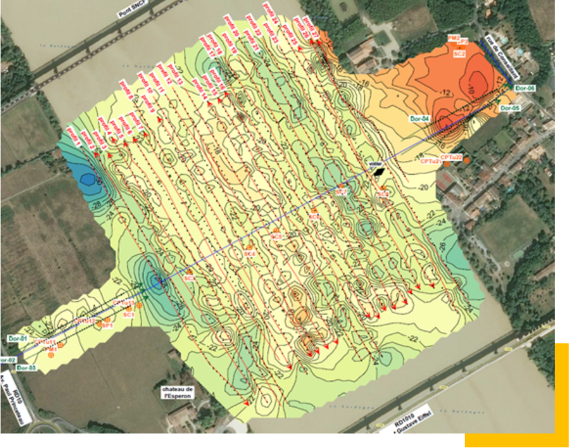
Geophysical investigations complement geotechnical investigations, providing imaging of the soil layers, depths and interfaces along the entire length of the potential drill path.
Railway monitoring involves tracking and recording potential ground displacement caused by underground works, to ensure that conditions remain within acceptable limits.
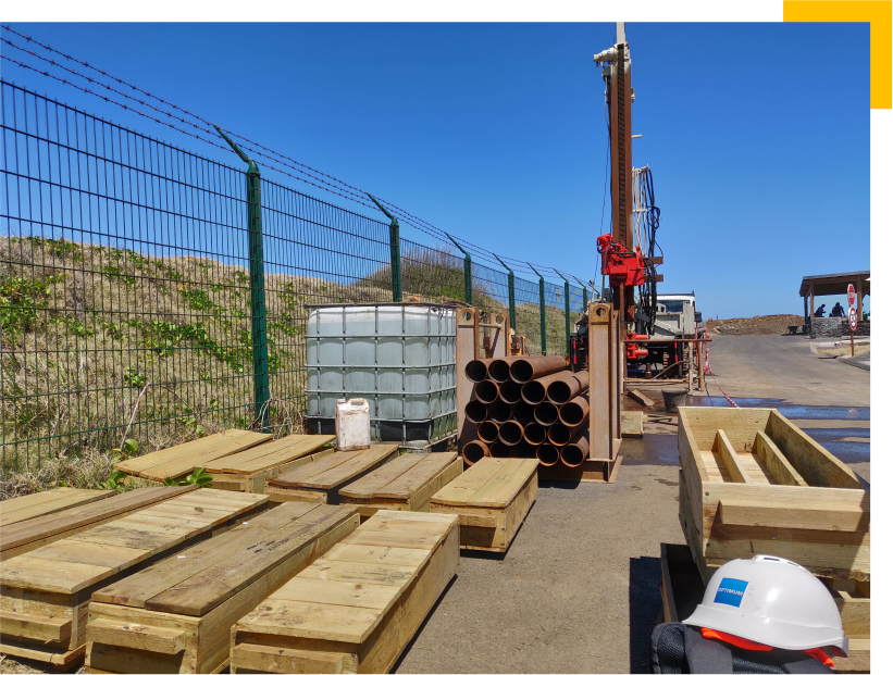
The importance of data collection for trenchless feasibility studies
With the exception of structural monitoring, which takes place during the works construction phase, investigations and data collection should be carried out prior to the detailed trenchless feasibility study (G2 PRO mission). This allows the trenchless engineer to fully understand the project’s environment and propose the most suitable and reliable solution.
Topography
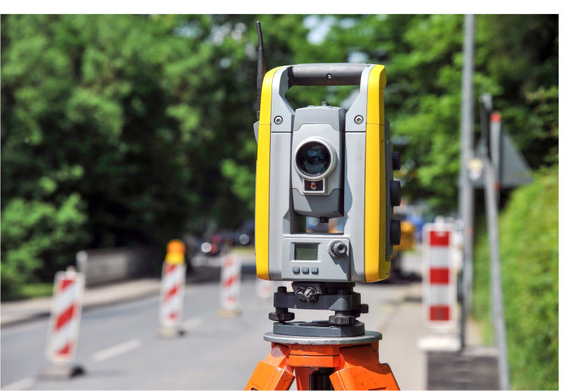
Essential data for every trenchless feasibility study
To correctly design a trenchless project, it is essential to have an accurate topographical survey along the entire length of the crossing path (low points, high points, changes in elevation, reliefs, etc.).
Surveys are taken to give the coordinates for each point (X, Y, and Z), using either GPS or drones, based on a predefined reference system specific to each region and/or country. This generates a representation of the project area, known as the Digital Terrain Model (DTM), which indicates all existing features and level variations: roads, pavements, ditches, trees, buildings, railways, rivers, natural terrain, etc. Based on the DTM, the trenchless engineer can then create the most reliable plans, profiles, and crossing sections possible.
Topography at a glance
In what context ?
For all feasibility studies
Why?
To ensure the trenchless project corresponds to the precise site conditions
Network detection
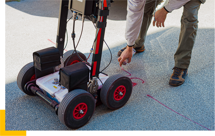
In addition to topography, the identification of existing underground networks is a critical point for trenchless works, particularly in urban and peri-urban areas.
Specific regulations establish the legal framework for planning and carrying out construction works near existing underground networks. As such, every OPTIMUM engineer is trained and certified as a designer of underground structures (AIPR certification – Authorization for Works Near Networks)..
Existing underground networks: A key challenge for trenchless works
Before the feasibility studies are carried out, all operators with underground networks within a predefined area are notified of potential trenchless works.
The operators are then required, within a few weeks, to confirm the presence or absence of their networks in the area.
If present, the operators must provide georeferenced plans of their networks.
Each network is then repositioned on the base maps collected during the topographic survey to ensure that the networks are correctly located.
The networks are classified into three categories, A, B, and C, based on the accuracy and degree of certainty of their location. Underground works can only proceed if all networks are classified as A, meaning they are located with an accuracy of 50cm.
If the networks are classified as B or C, additional on-site investigations must be carried out.
The trenchless engineer can, therefore, be certain during the design phase, of the precise location of the various networks and so ensure that the crossing profile avoids and maintains an dadequate distance from all existing underground networks.
Network detection at a glance
In what context ?
Mandatory for all trenchless projects
Critical for projects in urban, peri-urban and high density network areas
Why?
To ensure the most reliable trenchless project design
To guarantee the integrity of existing networks
To ensure smooth running of the trenchless construction phase
Geotechnical investigations
Geotechnical investigations are essential for determining the mechanical characteristics of the ground to be crossed. They are crucial for the detailed feasibility study (G2 PRO mission) and are generally carried out after the preliminary study (G1 ES / PGC mission).
Each trenchless project is unique and requires a tailored programme of geotechnical investigations, based on the site context and the anticipated crossing technique. It is, therefore, essential that the programme is developed by a specialist trenchless engineer, who will pinpoint the exact position of each borehole, as well as the type, depth and tests to be conducted on-site.
A provisional laboratory testing programme is also prepared by the trenchless engineer ahead of the campaign. It is important though to adjust this programme once the actual site conditions are known, i.e., after the borehole sampling, to avoid unnecessary tests and to ensure that no critical information is overlooked for the subsequent stages of analysis.
Geotechnical investigations are typically a combination of the following:
Core drills, to obtain undisturbed samples
Destructive boreholes, to assess soil consistency
Excavations, to evaluate the size and quantity of large elements that exceed borehole dimensions
Some boreholes may also be equipped with piezometers to measure fluctuations in the water table level over time.
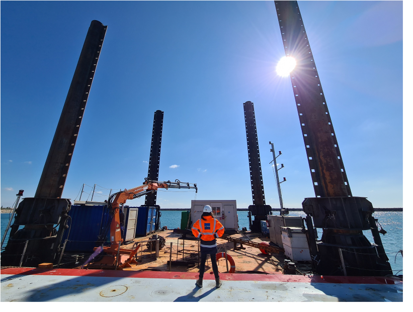
When combined with geophysical testing, these geotechnical tests enable a reliable soil model and an interpretive geotechnical profile to be created, both of which are essential to accurately design the trenchless crossing.
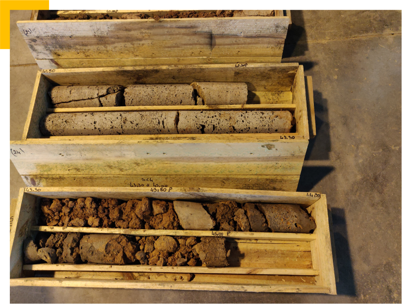
Most common in-situ tests
Soil permeability: This is a key parameter in trenchless work as it helps determine how easily fluid can move through a formation. This is particularly important if a fluid is being used for excavation, e.g., in HDD and Microtunnelling
Pressiometric tests: These tests measure the mechanical parameters (limit pressures, creep pressures), which characterise the consistency of the ground at a specific point
Penetrometer tests (Cone Penetration Test / Standard Penetration Tests): These provide similar information to pressiometric tests. CPT, however, has the advantage of continuously testing the soil. It is also less sensitive to operator precision and can evaluate liquefaction potential
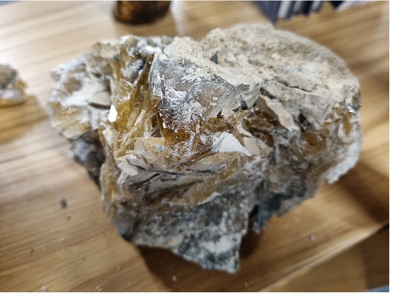
Laboratory tests for granular soils (sand or gravel) include
Grain size or sedimentometry: Measures the size of the soil particles
Atterberg limits: Measures the clay content of materials and provides a good indication of their stickiness or swelling potential
Methylene blue test: In addition to grain size and sedimentometry, this test helps assess the stickiness or swelling potential of clay
Triaxial / Shear tests: These measure the intrinsic parameters of a soil, including the angle of friction and cohesion
Laboratory tests for rocky soils include
Compressive strength tests, which can be measured directly (UCS) or indirectly (Franklin): It is advisable that both measurements be combines to ensure the true strength of the rock matrix is assessed, rather than the strength of the cementation of an existing fracture plane
Tensile strength (Brazilian test), which helps evaluate the rock’s drillability
Abrasion and hardness test (Cerchar test)
These rock tests help estimate potential drilling or tunnelling challenges, anticipate the type of tools required, and assess their wear and tear during the construction phase.
Geophysical investigations
A valuable addition to geotechnical investigations
Geophysical investigations are a valuable addition to geotechnical investigations in complex geotechnical or geological contexts and for large-scale structures.
These investigations help complement data gathered in a borehole-specific and destructive manner and allow for the geotechnical profile to be precisely refined over the entire crossing length. The results can also help refine or complete the geotechnical investigation programme, particularly by targeting areas where anomalies have been detected.
The geophysical investigation programme is usually established during the preliminary feasibility study (G1 PGC mission) and then adapted according to the project specifics: site conditions, trenchless crossing depth, the degree of accuracy required.
Various data acquisition methods exist, such as electrical or seismic techniques, and should be selected based on the specificities of each site as well as the depth of investigation needed for the project.
Railway monitoring
Trenchless works always result in a modification of ground conditions. The extent of this modification will vary, depending on the trenchless technique being used, the site context, and the depth of the installation. Crossings under existing structures, such as railway lines, require special attention and specific measures to ensure that underground works do not cause any surface disruption.
Before and after the works: Verification of the railway platform to ensure that no disruption has occurred that could affect the surrounding environment. Depending on the depth of the trenchless installation, the survey can be carried either
-
- By georadar: Images are taken before and after drilling / tunnelling beneath the tracks. Any disturbances can be detected by comparing the two images.
- By geophysical investigation, notably seismic testing, if the trenchless crossing is located in very deep formations and/or below the water table.
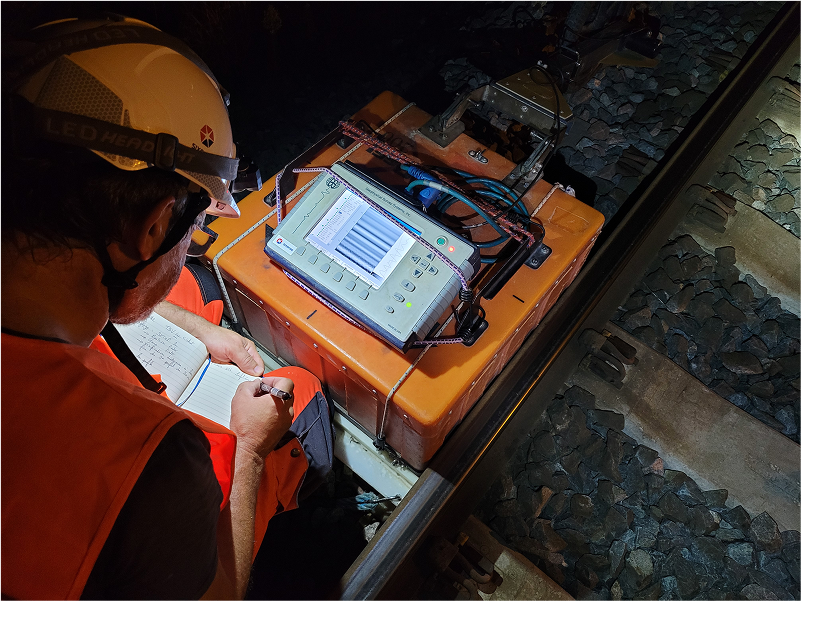
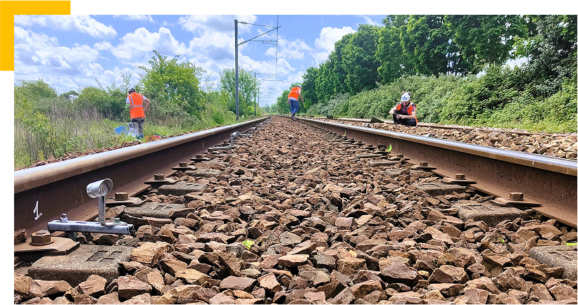
During the works: Thorough and continuous monitoring of the structural integrity of the railway is essential. This involves placing sensors along the tracks and taking regular topographical positioning measurements, triggering automatic alerts if any deviation from the established parameters is registered.
After works completion: A period of residual monitoring confirms that no underground cavities have formed over time. At the end of these checks, the monitoring devices are removed, and normal rail traffic conditions can resume.
